

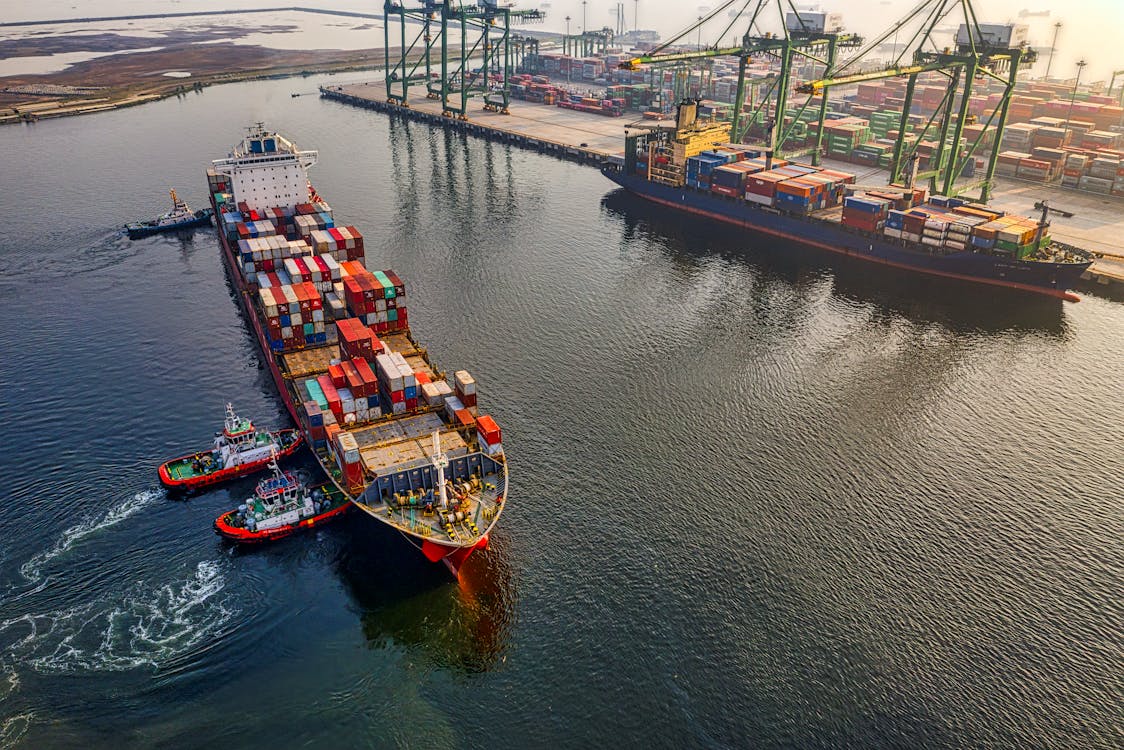
Maritime shipping vessels are the superheroes of global trade. These floating giants navigate vast oceans, ensuring goods reach every corner of the globe.
Back in 2022, the daily earnings of such a vessel around the globe were nearly $50,000 USD per day. Such a high sum of money clearly indicates just how important these ships are to our global economy.
These massive cargo ships are also operating in the middle of the ocean, contending with rough seas, unpredictable weather, piracy, and other vulnerabilities. All these can transform a routine voyage into a dangerous ordeal.
In 2022, there were 11 recorded attacks on container ships by pirates, with maritime piracy taking place around 115 times that same year. But these vessels aren’t just vulnerable to piracy. Rough seas can impact cargo onboard vessels, with many losing between one to hundreds of containers due to sea and weather conditions.
Thankfully, maritime shipping vessels have satellite connectivity to give them real-time weather and sea condition data, along with enabling sensors and IoT capabilities to keep ships protected from piracy attempts. Today’s connectivity options are helping to protect ships in ways unimaginable just a few decades ago.
Keeping Ships Safe from Above
Imagine steering a massive cargo ship through a vast ocean without a clue about what lies ahead. Sounds nerve-wracking, right? Satellites ensure that’s a problem of the past.
By providing real-time weather updates, satellite systems help ships avoid storms, rogue waves, and other natural hazards. With advanced imaging, they also enable early detection of icebergs and floating debris.
Piracy is another challenge that has plagued shipping routes for centuries. Modern satellites help tackle this problem by offering surveillance capabilities. Using high-resolution imagery, they can track suspicious vessels in piracy-prone areas, helping authorities respond quickly.
Satellite Internet Service
Now, let’s talk about staying connected. Ever been frustrated by slow internet when you’re just a mile from a city? Imagine being thousands of miles away in the middle of the ocean. That’s where satellite internet service comes to the rescue, offering high-speed internet no matter how far vessels roam.
Shipping crews rely on this connectivity for everything – from navigating routes and checking weather conditions to staying in touch with their families.
Starlink internet is one such technology helping to keep today’s cargo sector connected. Starlink internet is being offered across the world thanks to the company’s 6,000+ satellites that operate in low Earth orbit (LEO).
Maritime communications provider, Speedcast, notes that Starlink offers speeds of up to 350 Mbps in the open waters. These speeds support everything from keeping ship operations connected, to allowing crew members to stream videos, play online games, and stay active on social media during downtime, reducing isolation and boosting morale.
Operating Smarter with Satellite Navigation
If satellite internet keeps vessels connected, satellite navigation ensures they don’t get lost. GPS technology has transformed maritime travel, making it incredibly accurate and efficient.
Ships no longer rely solely on stars and compasses. Instead, they use satellites to determine their precise location and chart the safest, most fuel-efficient courses.
Think of satellites as the dependable road signs of the sea. They make sure ships don’t stray into dangerous territories, like shallow waters or restricted zones. Also, when accidents happen, like a ship running aground, satellite data can help pinpoint the exact location and guide rescue efforts.
Environmental Watchdogs
Here’s something you might not have known: satellites aren’t just about keeping ships safe; they’re also protecting the environment from shipping activities. With their eagle-eyed surveillance, satellites monitor emissions, track oil spills, and even keep tabs on illegal fishing activities.
By helping authorities enforce maritime regulations, satellites ensure that shipping doesn’t come at the cost of marine ecosystems. They’re the guardians of the deep blue, ensuring that both ships and sea creatures coexist peacefully.
As technology evolves, the role of satellites in maritime shipping is only set to grow. Artificial intelligence, paired with satellite data, is already enabling predictive analytics that can foresee potential dangers before they happen. Autonomous shipping vessels, guided by satellites, are on the horizon too. It’s not quite science fiction, but it’s close enough to feel exciting.
Soon, we may see satellites offering even faster, more robust communication solutions, further enhancing the safety and efficiency of maritime operations.
 The Growing Role of Zero-Trust Architecture in Online Gambling Security
 MPO Recognized as “Visionary” in Gartner Magic Quadrant
 Top Nine B2B UX Design Services Companies in the USA
 Finding Inventory through ERP in a Business 4.0 environment
 What does the New Prime Minister mean for sustainability? Tackling the environmental crisis
 IBM Security new report – data breach average a record $4.4million!